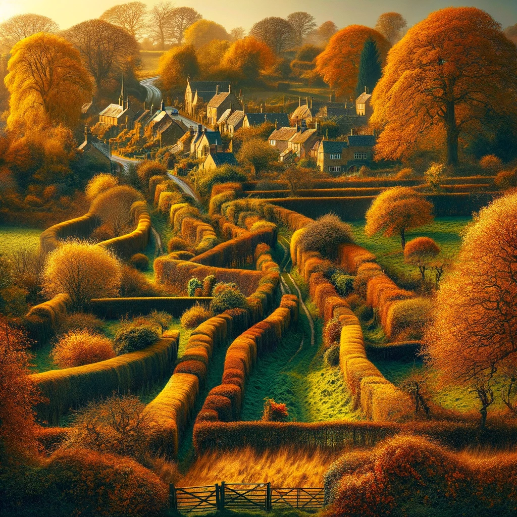
Paul Holmes -
University
English Professor

Free Materials For ESL Teachers and Learners

English Newsroom

Learn English through news articles - complete lesson plans, including articles, listening, classroom activities, quiz questions and more!

England’s Hedgerows: A Vital Resource for Wildlife and Carbon Storage

England's hedgerows, which stretch almost ten times around the Earth, are a valuable resource that provide food and shelter for wildlife and store large amounts of carbon, and a new map created through aerial laser scanning will help identify gaps in the hedgerow network that can be filled in to expand and protect these important features of the landscape.

Try this article at a different level?


A new map of England’s hedgerows has revealed that if they were lined up end to end, they would stretch almost ten times around the Earth. This comprehensive map, the most detailed to date, provides valuable data for ecologists who hope it will lead to better protections for these important features of the landscape. Hedgerows are not only aesthetically pleasing, but they also provide food and shelter for wildlife and store large amounts of carbon. Laser scanning from the air has revealed a total of 390,000 km of hedges in England, with the South West having the largest share.

Dr. Richard Broughton of the UK Centre for Ecology and Hydrology, who led the project, stated that England likely has more hedgerows than anywhere else in the world, making it a valuable resource. The national policy is to expand hedgerows, and this map will help identify gaps in the hedgerow network that can be filled in. Hedgerows have been a part of the British countryside since the Bronze Age, serving as boundaries and enclosures for cattle. They are home to hundreds of different plant species and provide shelter for nesting birds, small mammals, and insects. Additionally, they can capture and store significant amounts of carbon.

Unfortunately, about half of Britain’s hedgerows were lost between the 1940s and 1990s, primarily in England, due to intensive farming and development. While the rate of loss has slowed since the 1990s, neglect, damage, and removal still pose significant threats. The new map, created using aerial laser scanning called Lidar, provides more detailed information than previous estimates based on field surveys. It calculates that there are 390,000 km of hedgerows in England, ranging in height from 1 to 6 meters. There are also an additional 67,000 km of lower hedges and 185,000 km of overgrown hedges above 6 meters tall.

The map also reveals regional and county-level variations in hedgerow density. The South West has the highest share of hedgerows, while the northeast has the lowest. At the county level, Somerset, Derbyshire, and Cornwall have the highest densities, while Surrey, Hampshire, and Berkshire have the lowest densities, excluding urban areas. The government has pledged to create or restore 48,000 km of hedgerows by 2037 and 72,000 km by 2050 as part of the new Environmental Improvement Plan.

Overall, this new map provides valuable information about England’s hedgerows, highlighting their importance and the need for their protection and expansion.

Original news source: England’s hedges would go around Earth ten times (BBC)

🎧 Listen:

Slow

Normal

Fast

📖 Vocabulary:

1comprehensiveIncluding or dealing with all or nearly all elements or aspects of something
2ecologistsScientists who study the relationships between living organisms and their environment
3aestheticallyIn a way that is pleasing to the senses, especially the sight
4carbonA chemical element that is a key component in organic compounds and can be stored in various ways in the natural world
5laserA device that emits light through a process of optical amplification based on the stimulated emission of electromagnetic radiation
6enclosuresAreas or spaces that are enclosed or separated by boundaries
7mammalsWarm-blooded vertebrates that have hair or fur and whose females produce milk for their young
8intensiveCharacterized by a high level of effort, energy, or activity
9LidarA remote sensing technology that measures distance by illuminating a target with laser light and analyzing the reflected light
10neglectThe act of ignoring or not caring for something, leading to its deterioration
11variationsDifferences or deviations from the norm within a certain area or among elements
12densityThe measure of how much of something exists within a certain area
13pledgedFormally committed to do something
14restorationThe act of bringing something back to its original condition or state
15importanceThe state or fact of being of great significance or value

Group or Classroom Activities

Warm-up Activities:

– Charades
Instructions: Divide the class into two teams. Give each team a set of hedgerow-related words or phrases written on small pieces of paper. One member from each team will come to the front of the class and act out the word or phrase without speaking. The team members must guess what the word or phrase is within a certain time limit. The team with the most correct guesses wins.

– News Summary
Instructions: Give each student a copy of the article. In pairs, students will take turns summarizing the main points of the article to their partner. After each summary, the partner will provide feedback and suggest any important details that were missed. After a few minutes, switch roles and repeat the activity with a different partner.

– Opinion Poll
Instructions: Create a list of statements related to hedgerows, such as “Hedgerows are important for wildlife conservation” or “Hedgerows should be protected by law.” Have students move to different areas of the classroom to indicate their level of agreement or disagreement with each statement. Once everyone has chosen a spot, ask a few students to explain their opinions and encourage a discussion among the class.

– Vocabulary Pictionary
Instructions: Write a variety of hedgerow-related vocabulary words or phrases on separate slips of paper. Divide the class into two teams. One member from each team will come to the front of the class and choose a slip of paper. They must then draw a picture to represent the word or phrase while their team tries to guess what it is. The team with the most correct guesses wins.

– Future Predictions
Instructions: In pairs or small groups, have students discuss and make predictions about the future of hedgerows in England. They should consider factors such as conservation efforts, climate change, and agricultural practices. Each group will then present their predictions to the class, explaining their reasoning and supporting their ideas with evidence from the article.

🤔 Comprehension Questions:

1. What is the purpose of the new map of England’s hedgerows?
2. Why are hedgerows considered important features of the landscape?
3. How many kilometers of hedges were revealed by the laser scanning?
4. According to Dr. Richard Broughton, why are England’s hedgerows a valuable resource?
5. What factors contributed to the loss of hedgerows in Britain between the 1940s and 1990s?
6. How does the new map provide more detailed information than previous estimates?
7. Which region of England has the highest share of hedgerows?
8. What are the government’s plans for creating or restoring hedgerows in the future?
Go to answers ⇩

🎧✍️ Listen and Fill in the Gaps:

A new map of England’s hedgerows has revealed that if they were lined up end to end, they would stretch almost ten times around the Earth. This comprehensive map, the most detailed to date, (1)______s valuable data for ecologists who hope it will lead to better protections for these important features of the landscape. Hedgerows are not only aesthetically pleasing, but they also provide food and shelter for wildlife and store large amounts of carbon. Laser scanning from the air has revealed a total of 390,000 km of (2)______ in England, with the (3)______ West having the largest share.

Dr. Richard Broughton of the UK (4)______ for Ecology and Hydrology, who led the project, stated that (5)______ likely has more hedgerows than anywhere else in the (6)______, making it a valuable (7)______. The national (8)______ is to expand hedgerows, and this map will help identify gaps in the hedgerow network that can be filled in. Hedgerows have been a part of the British countryside since the Bronze Age, serving as boundaries and enclosures for cattle. They are home to hundreds of different plant species and provide shelter for nesting birds, small mammals, and insects. Additionally, they can capture and store significant amounts of carbon.

Unfortunately, about half of Britain’s (9)______ were lost between the 1940s and 1990s, primarily in England, due to intensive farming and development. While the rate of loss has slowed since the 1990s, neglect, damage, and removal still pose significant threats. The new map, created using aerial laser scanning called (10)______, (11)______ more detailed information than previous (12)______ based on field surveys. It calculates that there are 390,000 km of hedgerows in England, ranging in height from 1 to 6 meters. There are also an additional 67,000 km of lower hedges and 185,000 km of overgrown hedges above 6 meters tall.

The map also reveals regional and county-level variations in hedgerow density. The South West has the highest share of hedgerows, while the northeast has the (13)______. At the county level, Somerset, Derbyshire, and Cornwall have the highest densities, while Surrey, Hampshire, and Berkshire have the lowest densities, excluding urban areas. The (14)______ has pledged to (15)______ or restore 48,000 km of hedgerows by 2037 and 72,000 km by 2050 as part of the new Environmental Improvement Plan.

Overall, this new map provides (16)______ information about England’s hedgerows, highlighting their importance and the need for their protection and expansion.
Go to answers ⇩

💬 Discussion Questions:

Students can ask a partner these questions, or discuss them as a group.

1. What is the purpose of hedgerows in the British countryside?
2. How would you feel if the hedgerows in your country were being lost due to farming and development?
3. Do you think it is important to protect and expand hedgerows? Why or why not?
4. What are some potential benefits of expanding hedgerows?
5. How do you think the loss of hedgerows in England has affected wildlife?
6. Do you have hedgerows in your country? If so, what are they used for?
7. How would you feel if your government pledged to create or restore thousands of kilometers of hedgerows?
8. What steps do you think can be taken to protect hedgerows from neglect, damage, and removal?
9. Why do you think the South West of England has the highest share of hedgerows?
10. How do you think the loss of hedgerows has impacted the aesthetic appeal of the British countryside?
11. Do you think other countries should follow England’s lead and create detailed maps of their hedgerows? Why or why not?
12. What role do you think hedgerows play in combating climate change?
13. How do you think the loss of hedgerows has affected the nesting habits of birds?
14. What measures do you think can be taken to encourage farmers and developers to protect hedgerows?
15. How would you feel if the government in your country had a national policy to expand hedgerows?

Individual Activities

📖💭 Vocabulary Meanings:

Match each word to its meaning.

Words:
1. comprehensive
2. ecologists
3. aesthetically
4. carbon
5. laser
6. enclosures
7. mammals
8. intensive
9. Lidar
10. neglect
11. variations
12. density
13. pledged
14. restoration
15. importance

Meanings:
(A) A remote sensing technology that measures distance by illuminating a target with laser light and analyzing the reflected light
(B) A device that emits light through a process of optical amplification based on the stimulated emission of electromagnetic radiation
(C) In a way that is pleasing to the senses, especially the sight
(D) Areas or spaces that are enclosed or separated by boundaries
(E) Including or dealing with all or nearly all elements or aspects of something
(F) Formally committed to do something
(G) Differences or deviations from the norm within a certain area or among elements
(H) The act of ignoring or not caring for something, leading to its deterioration
(I) Scientists who study the relationships between living organisms and their environment
(J) The act of bringing something back to its original condition or state
(K) Warm-blooded vertebrates that have hair or fur and whose females produce milk for their young
(L) Characterized by a high level of effort, energy, or activity
(M) The measure of how much of something exists within a certain area
(N) A chemical element that is a key component in organic compounds and can be stored in various ways in the natural world
(O) The state or fact of being of great significance or value
Go to answers ⇩

🔡 Multiple Choice Questions:

1. What is the main purpose of the new map of England’s hedgerows?
(a) To provide valuable data for ecologists
(b) To create a detailed map of the landscape
(c) To identify gaps in the hedgerow network
(d) To calculate the total length of hedgerows in England

2. How many kilometers of hedges were revealed by the aerial laser scanning?
(a) 67,000 km
(b) 390,000 km
(c) 185,000 km
(d) 1,000 km

3. What is one benefit of hedgerows?
(a) Acting as boundaries and enclosures for cattle
(b) Storing large amounts of water
(c) Capturing and storing significant amounts of oxygen
(d) Providing food and shelter for wildlife

4. What caused the loss of hedgerows in England between the 1940s and 1990s?
(a) Neglect, damage, and removal
(b) Aerial laser scanning
(c) Field surveys
(d) Intensive farming and development

5. Which region of England has the highest share of hedgerows?
(a) Northeast
(b) South West
(c) Southeast
(d) Midlands

6. Which counties have the highest densities of hedgerows?
(a) Surrey, Hampshire, and Berkshire
(b) London, Manchester, and Birmingham
(c) Somerset, Derbyshire, and Cornwall
(d) Yorkshire, Lancashire, and Cumbria

7. What is the government’s pledge regarding hedgerows?
(a) To create or restore 48,000 km by 2037 and 72,000 km by 2050
(b) To create or restore 390,000 km by 2037 and 67,000 km by 2050
(c) To create or restore 185,000 km by 2037 and 390,000 km by 2050
(d) To create or restore 67,000 km by 2037 and 185,000 km by 2050

8. What is the overall message of the article?
(a) England’s hedgerows are aesthetically pleasing but serve no other purpose
(b) England’s hedgerows are a valuable resource for intensive farming and development
(c) England’s hedgerows are important and need protection and expansion
(d) England’s hedgerows are disappearing at an alarming rate

Go to answers ⇩

🕵️ True or False Questions:

1. The new map of England’s hedgerows is the most detailed to date.
2. Less than half of Britain’s hedgerows were lost between the 1940s and 1990s.
3. The new map reveals regional and county-level variations in hedgerow density.
4. The government has committed to creating or restoring 48,000 km of hedgerows by 2037.
5. Hedgerows provide habitat and refuge for wildlife and store significant amounts of carbon.
6. England does not have more hedgerows than any other country in the world.
7. Laser scanning from the air revealed a total of 390,000 km of hedges in England.
8. The South West region of England has the largest share of hedgerows.
Go to answers ⇩

📝 Write a Summary:

Write a summary of this news article in two sentences.


Writing Questions:

Answer the following questions. Write as much as you can for each answer.

1. What are some of the benefits that hedgerows provide for wildlife and the environment?
2. How has the number of hedgerows in England changed over time?
3. How does the new map of hedgerows in England differ from previous estimates?
4. Which region in England has the highest density of hedgerows?
5. What are the government’s plans for creating and restoring hedgerows in the future?

Answers

🤔✅ Comprehension Question Answers:

1. The purpose of the new map of England’s hedgerows is to provide valuable data for ecologists and help lead to better protections for these important features of the landscape.
2. Hedgerows are considered important features of the landscape because they are aesthetically pleasing, provide food and shelter for wildlife, and store large amounts of carbon.
3. The laser scanning revealed a total of 390,000 km of hedges in England.
4. According to Dr. Richard Broughton, England’s hedgerows are a valuable resource because they likely have more hedgerows than anywhere else in the world.
5. The loss of hedgerows in Britain between the 1940s and 1990s was primarily due to intensive farming and development.
6. The new map provides more detailed information than previous estimates because it was created using aerial laser scanning called Lidar, which provides more accurate and comprehensive data.
7. The South West region of England has the highest share of hedgerows.
8. The government plans to create or restore 48,000 km of hedgerows by 2037 and 72,000 km by 2050 as part of the new Environmental Improvement Plan.
Go back to questions ⇧

🎧✍️✅ Listen and Fill in the Gaps Answers:

(1) provide
(2) hedges
(3) South
(4) Centre
(5) England
(6) world
(7) resource
(8) policy
(9) hedgerows
(10) Lidar
(11) provides
(12) estimates
(13) lowest
(14) government
(15) create
(16) valuable
Go back to questions ⇧

📖💭✅ Vocabulary Meanings Answers:

1. comprehensive
Answer: (E) Including or dealing with all or nearly all elements or aspects of something

2. ecologists
Answer: (I) Scientists who study the relationships between living organisms and their environment

3. aesthetically
Answer: (C) In a way that is pleasing to the senses, especially the sight

4. carbon
Answer: (N) A chemical element that is a key component in organic compounds and can be stored in various ways in the natural world

5. laser
Answer: (B) A device that emits light through a process of optical amplification based on the stimulated emission of electromagnetic radiation

6. enclosures
Answer: (D) Areas or spaces that are enclosed or separated by boundaries

7. mammals
Answer: (K) Warm-blooded vertebrates that have hair or fur and whose females produce milk for their young

8. intensive
Answer: (L) Characterized by a high level of effort, energy, or activity

9. Lidar
Answer: (A) A remote sensing technology that measures distance by illuminating a target with laser light and analyzing the reflected light

10. neglect
Answer: (H) The act of ignoring or not caring for something, leading to its deterioration

11. variations
Answer: (G) Differences or deviations from the norm within a certain area or among elements

12. density
Answer: (M) The measure of how much of something exists within a certain area

13. pledged
Answer: (F) Formally committed to do something

14. restoration
Answer: (J) The act of bringing something back to its original condition or state

15. importance
Answer: (O) The state or fact of being of great significance or value
Go back to questions ⇧

🔡✅ Multiple Choice Answers:

1. What is the main purpose of the new map of England’s hedgerows?
Answer: (a) To provide valuable data for ecologists

2. How many kilometers of hedges were revealed by the aerial laser scanning?
Answer: (b) 390,000 km

3. What is one benefit of hedgerows?
Answer: (d) Providing food and shelter for wildlife

4. What caused the loss of hedgerows in England between the 1940s and 1990s?
Answer: (d) Intensive farming and development

5. Which region of England has the highest share of hedgerows?
Answer: (b) South West

6. Which counties have the highest densities of hedgerows?
Answer: (c) Somerset, Derbyshire, and Cornwall

7. What is the government’s pledge regarding hedgerows?
Answer: (a) To create or restore 48,000 km by 2037 and 72,000 km by 2050

8. What is the overall message of the article?
Answer: (c) England’s hedgerows are important and need protection and expansion
Go back to questions ⇧

🕵️✅ True or False Answers:

1. The new map of England’s hedgerows is the most detailed to date. (Answer: True)
2. Less than half of Britain’s hedgerows were lost between the 1940s and 1990s. (Answer: False)
3. The new map reveals regional and county-level variations in hedgerow density. (Answer: True)
4. The government has committed to creating or restoring 48,000 km of hedgerows by 2037. (Answer: False)
5. Hedgerows provide habitat and refuge for wildlife and store significant amounts of carbon. (Answer: False)
6. England does not have more hedgerows than any other country in the world. (Answer: False)
7. Laser scanning from the air revealed a total of 390,000 km of hedges in England. (Answer: True)
8. The South West region of England has the largest share of hedgerows. (Answer: True)
Go back to questions ⇧

How about these other Level 4 articles?

Researchers at Columbia University have developed an AI tool that can identify whether fingerprints from different fingers belong to the same person with 75-90% accuracy, challenging the belief that each fingerprint is completely unique.

AI Tool Challenges Belief in Unique Fingerprints

Researchers at Columbia University have developed an AI tool that can identify whether fingerprints from different fingers belong to the same person with 75-90% accuracy, challenging the belief that each fingerprint is completely unique.

Feedback